News
Red Sea Crude Tankers Pivot as Blockade Forces U-Turns
Saudi oil shipments intended for Asia are turning back inside the Red Sea. When vessel transponders go silent, spaceborne radar confirms where the barrels are actually heading.
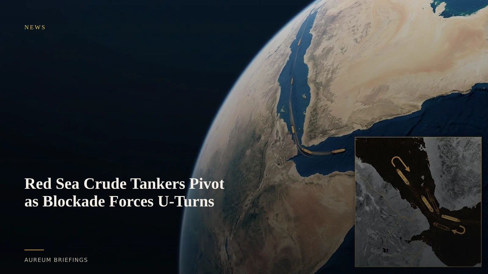
Saudi crude flows shift from Bab el-Mandeb to Suez
Commercial crude shipping patterns in the Middle East took a sudden turn this week. Multiple supertankers loaded with Saudi Arabian crude bound for Asian markets reversed course after departing the Red Sea terminal of Yanbu.
According to recent Red Sea shipping incident reports, vessels that originally planned to pass south through the Bab el-Mandeb strait made sharp U-turns. They are now heading north toward the Suez Canal and Egypt's SUMED pipeline bypass.
Yanbu handles approximately 4 million barrels per day of crude exports. While diverted routing around the Cape of Good Hope adds up to two weeks of transit, crossing north into the Mediterranean preserves immediate delivery capacity to Europe and North America.
Why public AIS transponder maps miss the full picture
Traders relying solely on automated identification system (AIS) transponders face severe blind spots during active naval disruptions. Captains frequently disable AIS broadcasts or face intense military electronic interference.
Data published by IMF PortWatch maritime monitoring highlights how widespread AIS spoofing, GPS jamming, and dark vessels complicate conventional trade calculations in maritime chokepoints.
When transponder pings vanish from popular AIS feeds, raw charts make it look like global supply has stopped. In reality, the ships are still in motion, operating under complete radio silence.
Piercing radio silence with satellite synthetic aperture radar
To verify physical position without radio signals, satellite surveillance relies on active radar systems. Synthetic aperture radar (SAR) bounces microwave pulses off the ocean surface to construct precise metallic imagery regardless of darkness, cloud cover, or heavy weather.
Open platforms like the ESA Copernicus Earth observation program established the long-term utility of C-band SAR for tracking oil spills, sea ice, and vessel signatures in contested waters.
While lightweight open-source OSINT dashboards aggregate public APIs for fire and flight data, institutional physical analysis requires combining multi-temporal radar passes to confirm exact vessel length, heading, and draft changes.
How market participants act on verified transit shifts
When physical supply routes change direction, freight rates, regional crude spreads, and refinery intake schedules reprice rapidly.
Instead of waiting days for official customs declarations or broker newsletters, commodity traders use satellite metrics to quantify how many crude carriers remain anchored off Yanbu versus those actively traversing the Suez northern approach.
Aureum delivers this intelligence directly. Use Query to ask specific structural questions about supported port yards or channel, and use Track to maintain a hand-built watchlist of critical global trade lines.
See what changed before the report prints
Get direct access to satellite-backed physical economy metrics. Track live chokepoints or query real-world locations on demand.