Briefing
Closing the Satellite Intelligence Gap
The biggest funds watch the physical economy from space. Everyone else finds out later from the news. Aureum closes that gap.
The other side of the trade
Somewhere in the world, something you have a view on is happening right now. A data centre going up slower than the announcement said. Tesla lots filling, or not, in the weeks before a delivery number. Tankers moving through Hormuz this morning, or sitting still.
What do you do about it? You Google it. You wait for the news. You ask ChatGPT. But news is what happened after somebody else already knew, and a chatbot mostly repeats what has already been written down. Neither is monitoring the physical site this week.
Somebody is, though. And by the time the story reaches you, they have been positioned for days. You are not competing with them for the information. You are the other side of their trade.
For the rest of us
For years, only funds, banks and governments could use true satellite intelligence. They signed long contracts with satellite companies, kept specialists on staff, and kept the answers to themselves. They pay hundreds of thousands for this data, but they make millions.
Aureum is satellite intelligence for the rest of us. Ask a question in plain English. Get an answer built from recent satellite data, with the pictures, the numbers, and the analysis shown.
Aureum's Track system watches Earth for you: ports, factories, shipping lanes. The board moves when the world does.
The 'intel' in satellite intelligence is the expensive part
There are hundreds of imaging satellites in orbit. Google Maps is free. The European Space Agency and NASA give raw data away. So why is the edge still reserved for the rich?
Cost is an obvious answer. Sharp imagery is sold by the square kilometre, on contracts with minimum spends and long commitments. That's fine for a fund, but completely inaccessible to one person with one question.
Furthermore, getting a defensible number out of satellite data is a true maths problem, not an observation problem. Sun angle, atmosphere, calibration, seasons—the average DIY investor or journalist does not get answers by staring harder at a picture.
The freshest data is also the ugliest. Those crisp Google Earth tiles can be years old. What is genuinely current and usable is coarse, half-hidden by clouds, and often not a photograph at all. For instance, to the untrained eye, radar looks like television static, but it also sees through cloud and darkness.
Time is the final factor in this equation. Even professionals can spend hours to days answering one question with satellite data. The funds built a system for that. Everyone else reads the news.
Same place, twice
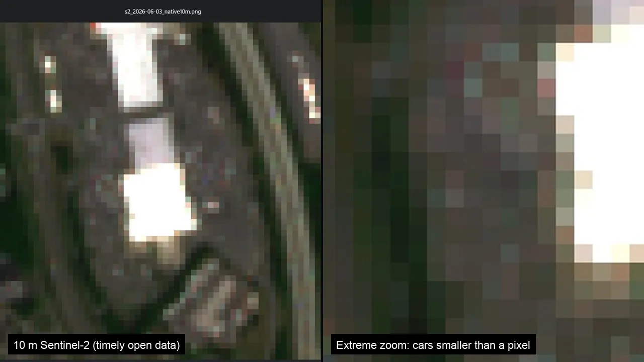
Below is a Walmart parking lot at ten metres per pixel. Left, the whole scene. Right, zoomed all the way in. You cannot find a single car.
Funds have made money from data exactly like this for years. How?
They are not looking at it. They are measuring it. You cannot see a car in a ten metre pixel, but you can measure how much of the lot is covered in metal this week against the same week last month, across hundreds of archived passes. Astronomers practise the same methods when measuring celestial bodies. They cannot see the shape of a distant star, yet they can still tell you exactly how it is changing.
Unlocked. Here's how Aureum evens the playing field. Request private beta access.
A parking lot in Albany
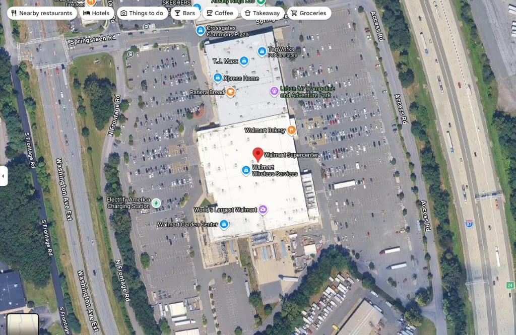
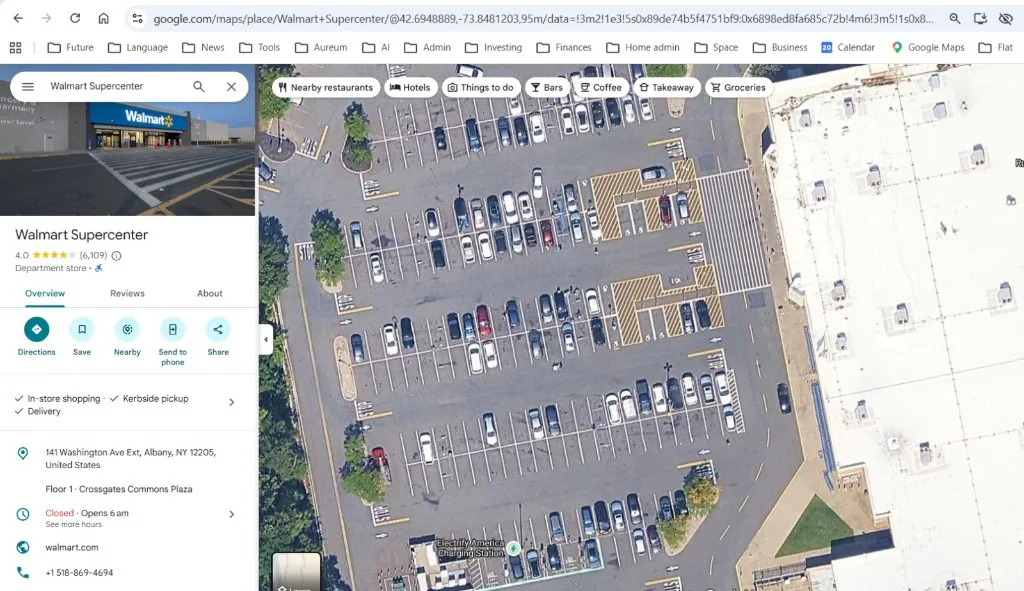
Open a Walmart outside Albany, New York in Google Maps. Car colours. Parking lines. Shopping trolleys, almost.
Sooner or later everyone has the same idea: just count the cars.
The postcard problem
That tile is sharp because it is old. Many update every few years, and the file rarely says when it was taken. No date means no change. No change means no signal.
We tried building on these tiles. You cannot. Not with money on the line. What you are looking at is a postcard from the past one to five years.
What this week actually looks like
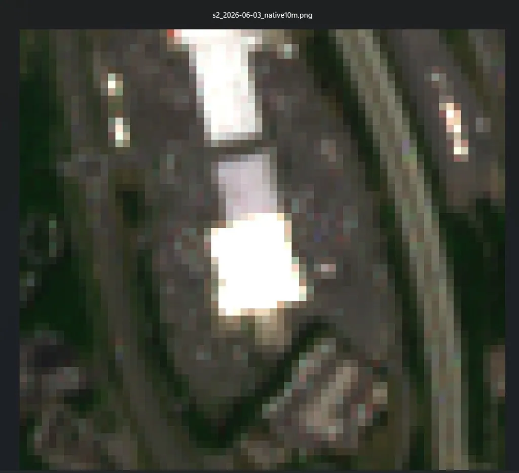
Here is the same Walmart lot using free Sentinel-2 data at ten metres per pixel. This is the coverage most free DIY analysis runs on, including most of what Aureum uses today.
Sentinel-2 takes a pass every few days. Clouds cover most of them. A clear look lands about once a week.
Count the cars
Zoom in and this is what you get. A bright roof. A dark lot. Specks that might be cars, or construction, or who knows. Roughly ten cars fit inside one pixel.
So, count them.
Finding the image took a few minutes. Getting a number you would act on is a full-time job.

It gets worse before it gets useful
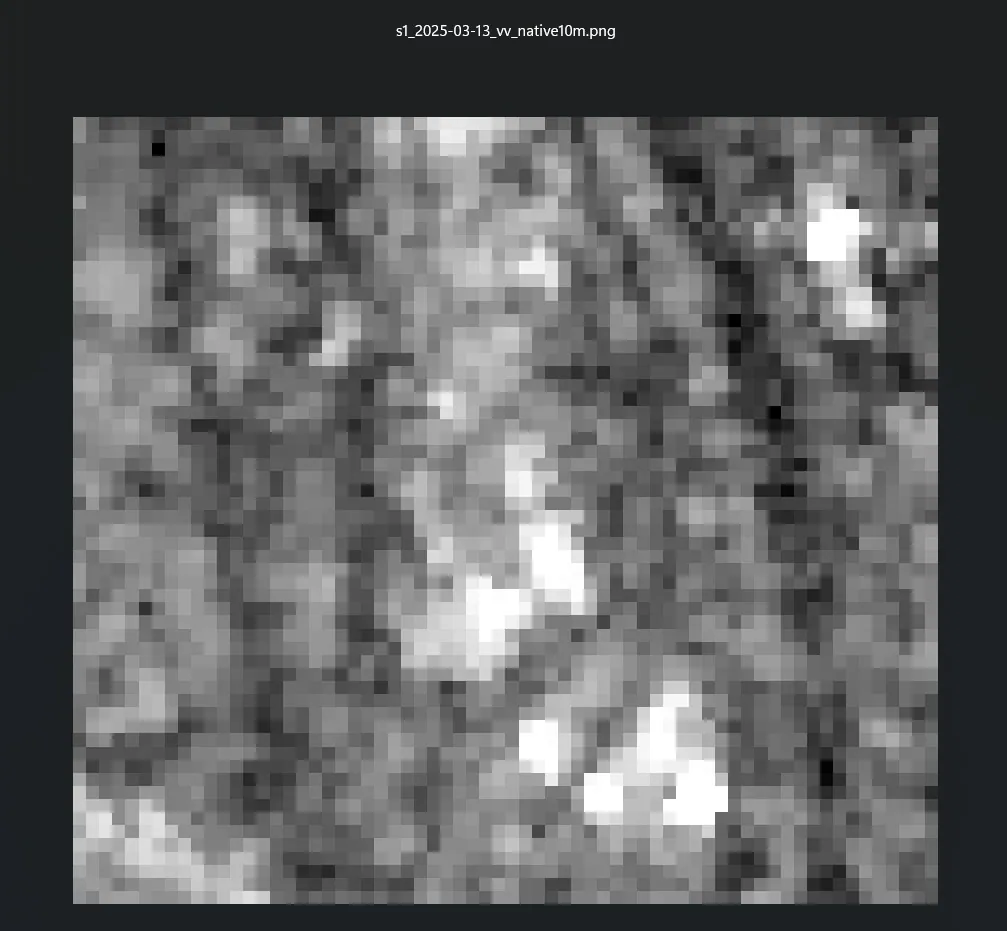
The same Walmart once more, using Sentinel-1 radar this time. No colour. No photo. Can you tell that is supposed to be a Walmart?
Radar is ugly but better. It lights up metal and hard edges, and it works at night and through clouds. Paired with an optical image, our Aureum AI models see what a person scrolling Google Earth never will.
That big, beautiful bill
You 'can' buy sharper imagery. Archive scenes at 30 centimetres run about ten to twenty dollars per square kilometre. A tasked fresh snapshot costs much more. Not many can afford to buy the planet weekly.
Aureum: Satellite intelligence in minutes, not days.
Aureum packages the entire process into two core products.
Query: ask in plain English, get a recent satellite-backed answer with the imagery, the measurement and the analysis.
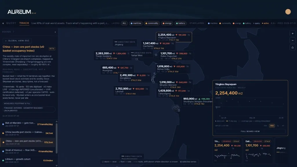
Track: hand-built boards on ports, shipping lanes, factories. The physical world on a board, the way a trade desk watches stock prices.
Here's a preview of Aureum Track: iron ore stocks at Chinese ports. Satellite-backed analysis in minutes, without the messy process you just read about.
Closing the gap
Satellite intelligence used to cost a specialist team and an institutional contract. The world kept moving anyway, and most people saw it after the headline.
Now you can just ask Aureum.
Want access?
Our private beta is open for applications. We are building a cohort of initial users who want to help us shape Aureum and democratise satellite intelligence for the world.